Landmannalaugar area is listed as one of the top hiking sites in the world by most nature magazines, and for good reason. Multicolored rhyolite mountains, geothermal valleys and hot springs, lava obsidian and many more natural phenomena make this region a prime destination for many outdoors enthusiasts. Book our Landmannalaugar hiking tour and discover why.
Among the country's most attractive sites, there are a few that are not that easy to access. That leaves them beyond the reach of mass tourism. Landmannalaugar is one of these unique sites. It is mainly visited by hikers and adventure travelers.
Pictures of its colorful mountains have gone viral on the internet. Most outdoor magazines rank Landmannalaugar among the best hiking sites in the world. It is not only the ultimate starting point for the legendary Laugavegur Trail, but the area features a huge network of amazing hiking trails, ranging from short but extremely scenic hikes to epic multi-day treks. Let us show you around Landmannalaugar!
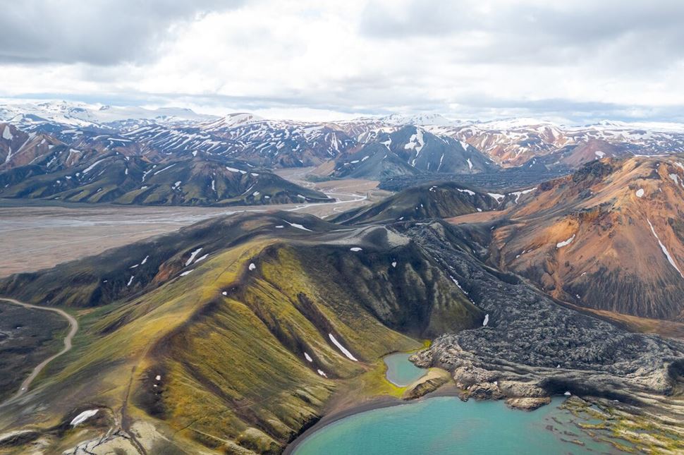
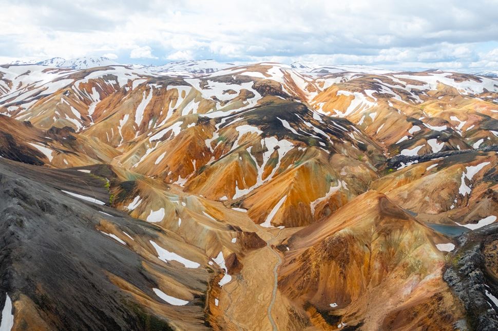
Landmannalaugar is part of the highly protected Fjallabak Nature Reserve. The area is widely known for its incredibly scenic landscapes, colorful mountains, and geothermal valleys. While most of Iceland’s land and mountains are made of dark, black volcanic rocks, the Landmannalaugar area holds the most silicic rocks in Iceland. These kinds of minerals - especially rhyolite - are very bright and colorful. Along with the number of unusual geological elements that can be found in these rocks, they give an incredibly unique look to the landscape.
Hikers on the Laugavegur trail in Landmannalaugar
These rainbow and chocolate-colored mountains were formed during numerous subglacial volcanic eruptions. More than 250 cubic kilometers (60 cubic miles) of rhyolite surfaced during these volcanic events and the area has shown strong geothermal activity for over one million years.
The last volcanic eruption took place in 1477 when the distinctive Laugahraun lava field was formed. The lava solidified and now a rough black mass stretches through the middle of the colorful valley. Rounded hills painted in shades of yellow, brown, pink, blue, and green surround the black lava, under which steaming hot water springs up here and there as a reminder of the powerful forces that hide deep beneath the surface.
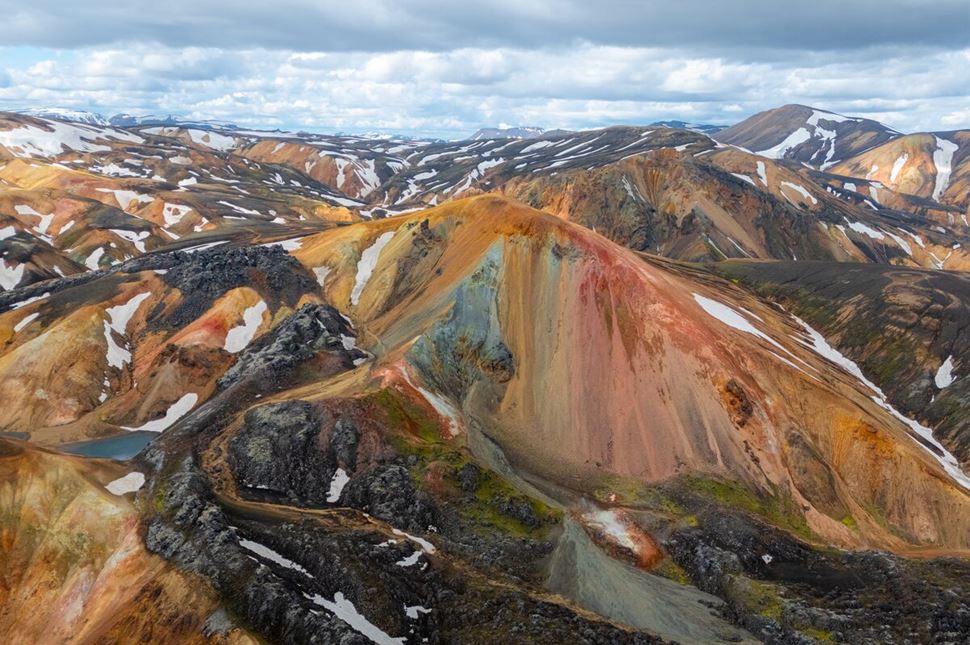
The site is famous for being the northern base of the epic Laugavegur trek, one of the most scenic hiking trails in the world. Most hikers start the trail here and hike 55 kilometers (34 miles) past snow-capped peaks, colorful mountains, and green valleys to reach Thórsmörk, the lush green birch valley.
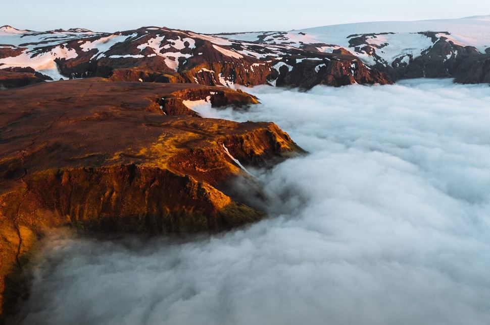
Some hikers choose to continue right away from Thórsmörk to Skógar on the Fimmvörðuháls Trail. It leads between three glaciers and through the mountain pass where a volcano erupted in 2010. This eruption created two brand-new scenic craters that you can even climb if you would like to.
Adding another 25 kilometers (15.5 miles), Laugavegur and Fimmvörðuháls together are 6-8 days of unforgettable adventure for sure! It is also possible to complete these hikes from the opposite direction, starting the Laugavegur Trail in Thórsmörk and ending in Landmannalaugar.
One of the most impressive short trails is the one that takes you up to a very colorful rhyolite mountain named Brennisteinsalda, the “Sulfur Wave.” Its peak is visible from the base camp and is highly scenic and inviting. It only takes 3-4 hours to hike up and to get back to the campsite.
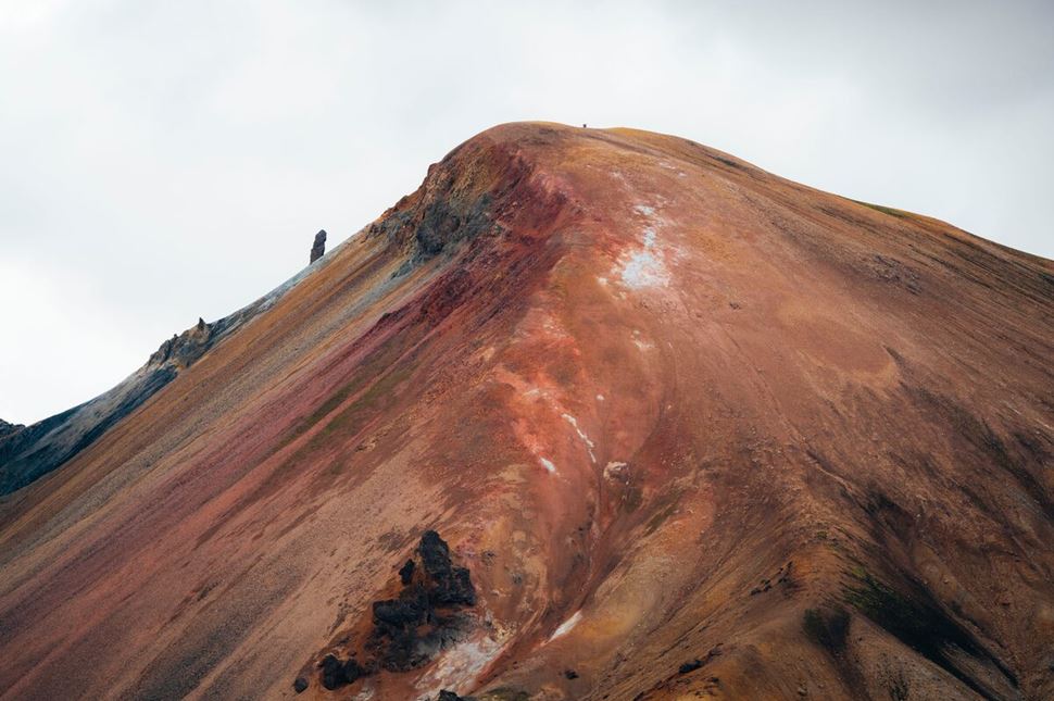
The Beautiful colors of Brennisteinsalda
The largest part of this hike shares the same trail as Laugavegur. The path leads across the thrilling Laugahraun obsidian lava field, passing by steaming hot sulfur springs and leading up to the 855-meter (2,805 foot) high mountaintop. From here, you will have a 360-degree panorama over the indescribable landscape. Coming down from the yellow mountain, you can finish your hike by walking through Grænagil Canyon where the walls and rocks are insanely blueish-green.
The other amazingly scenic hike takes you to the 916-meter (3,005 foot) high Bláhnúkur, the “Blue Peak.” This mountain is so blue that it is hard to believe it to be true if you have not seen it with your own eyes. The trail is quite steep but worth the climb. From the summit, you will have an unbelievable view over the base camp and all the colorful mountains in the area. In good weather, you can see further than 100 kilometres (62 miles)! Getting there and back from the campsite takes about two to four hours, depending on your fitness level and the number of photo stops. There will definitely be quite a few!
You can also connect these two peaks in just one hike to make a nice and truly unforgettable day trip. None of these trails are difficult. They are easy to follow and you will probably meet many other hikers. However, both hikes have sections that are pretty steep, so the time you will need for them depends highly on your fitness level. It is also good to remember that the trails are so scenic that you will probably need to stop for a photo every hundred meters, which will add to your hike time.
This short and easy circle is the best option for those with a tight timeframe, families with children, or people who are not used to hiking up steep hills or over longer distances. Even this trail can also be a little bit challenging sometimes, however, especially early or late in the season when it is snowy.
If you do not want to climb sheer slopes, this relatively easy walk through the obsidian lava field is the best option for you. It leads through the valley where you will be surrounded by breathtaking landscape from every direction. When you reach the foothills of the colorful Brennisteinsalda Mountain, you can turn left and follow the trail that takes you through the green Grænagil Canyon back to the campsite.
The name "Ljótipollur" translates into English as "the Ugly Puddle" which could not be less suitable for this beautiful site. Starting from Landmannalaugar this trail leads you through a lava flow up to Frostardarvatn. The first leg of the path is very short but pretty steep. From the top, you can enjoy the nice view over and the amazing volcanic features of the eruption that occurred in 1477. The most impressive lava formation is the cone of Stutur, which you can climb. Then, you can take the lower and flat path alongside Nordurnamur to reach the side of Ljotipollur lake. You can’t actually see the lake and the crater until you are on the edge of it.
The crater has a diameter of a bit more than 4 kilometres (2,48 miles) which will take you a bit more than an hour to walk around. After that, you can head back to Landmannalaugar following the Eastern side of Nordunamur and through the lava field coming from Stutur. It's a very flat and easy walk.
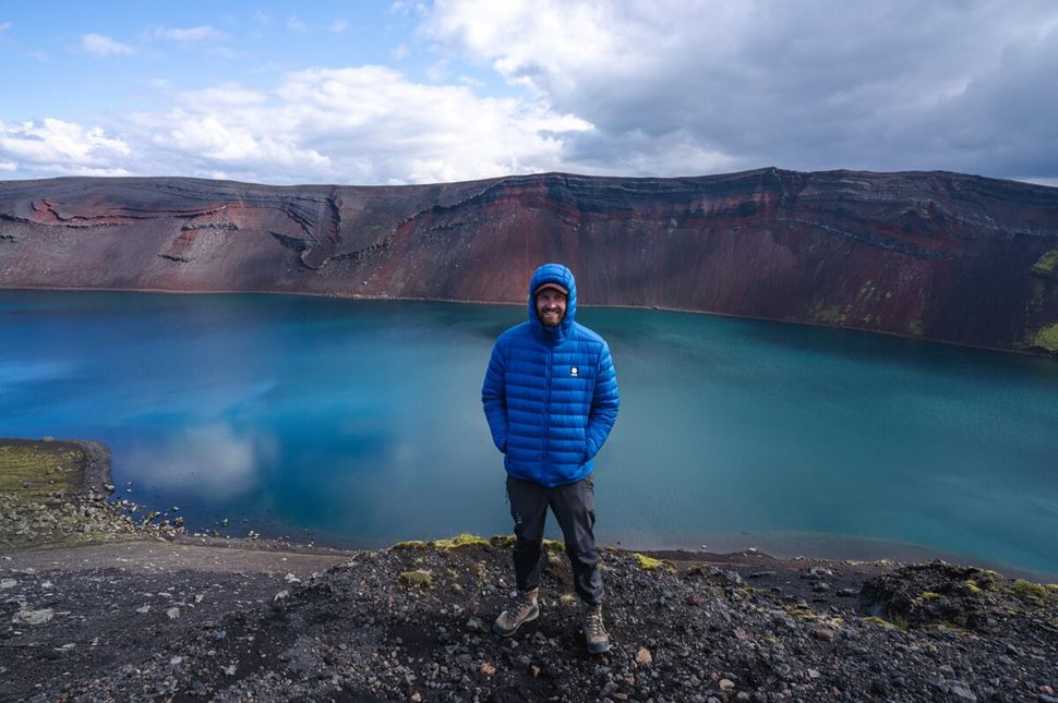
The Not-So-Ugly-Pond in Landmannalaugar
The Landmannalaugar Hot Spring is one of the most amazing natural hot springs in the country. As hot water surfaces from under the lava and gets mixed up in the cold streams, it creates a very friendly water temperature of around 36-40°C (96-104°F). The warm water flows into a small natural lagoon where anyone can enjoy it safely. What is better than relaxing in a natural hot pool surrounded by colorful mountains after an amazing hike?
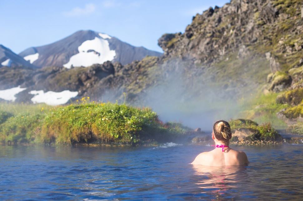
Landmannalaugar Valley translates to the “People’s Pool.” This refers to the long history of people enjoying the benefits of this warm oasis in the middle of nowhere. In the old days, traveling across the Highlands without Superjeeps or snowmobiles was a dangerous and very tiring journey. Landmannalaugar Valley served as a shelter for exhausted travelers who rested here to recharge themselves for the rest of their travels.
Today, both foreign visitors and domestic tourists come here to enjoy the most amazing combination of scenic hikes and relaxing baths in a natural hot spring. There are changing facilities and showers at the campsite which can be used for the small fee of 500 ISK. Do not forget to bring your swimsuit and towel when visiting this amazing place!
There is a spacious campsite in the valley which can be filled with tents during the high season. There is a large parking lot where cars can park separately. The campground is mainly gravel. Be prepared: it is not easy to drive your pegs into the ground. On windy nights, most campers use large rocks to weigh their tents down. It is a good idea to have a few extra stakes or pegs in case some get bent on stones.
There is a heated building with warm showers and toilets which is included in the camping fee. For those who are not staying overnight, using the toilet and the showers costs 500 ISK. It is recommended to take a shower both before and after bathing in the hot spring.
There is a roofed open dining area with benches where you can sit down to eat. At the information point, you can buy maps and inform yourself as to the weather warnings and trail conditions.
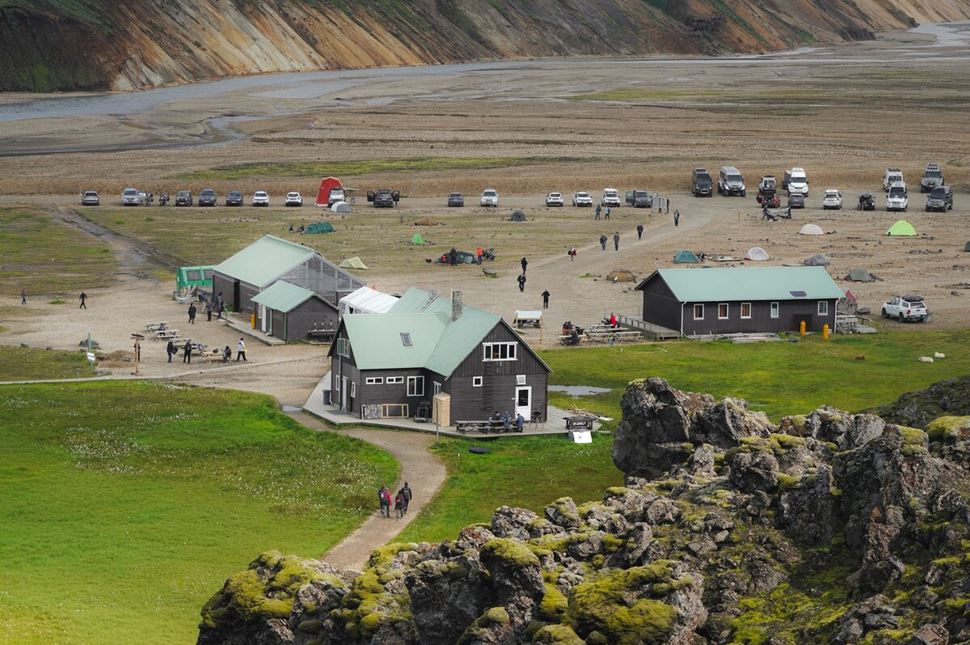
There is a large mountain hut operated by the Icelandic Touring Association. It is located about 600 meters (1968 feet) above sea level at the edge of the Laugahraun lava field in Landmannalaugar, only a few hundred meters away from the natural hot springs.
The two-story hut is spacious and accommodates 78 people. The ground floor has a large entrance hallway and a spacious sleeping hall with bunk beds. There is one small and three larger dorm rooms upstairs. Neither sleeping bags nor blankets are provided, therefore you need to bring your own. The hut is heated, so a light summer sleeping bag is sufficient.
The kitchen in the hut is equipped with gas stoves, warm and cold running water, and all of the necessary kitchen equipment. It is not possible to buy warm food or any kind of ready-made meals in the hut.
However, in Landmannalaugar, you can buy some basic supplies from an old school bus which is now called the “Mountain Mall.” There is another bus next to it where they sell hot soup. This is, however, exclusively available in Landmannalaugar. The other campsites and huts in the Highlands do not offer such services.
The hut shares the shower/toilet house with the campsite guests and visitors. Using the shower is not included in the hut price, it costs 500 ISK.
The huts in Landmannalaugar and along the Laugavegur Trail are in high demand. Therefore, it is essential to book your hut accommodation in advance. For campers, however, it is not necessary to book beforehand. If you book a guided hiking tour with us, we take care and guarantee of your accommodation.
Landmannalaugar is located approximately 180 kilometers (112 miles) or about a three-hour drive from Reykjavík. Therefore, it is possible to take a day tour of Landmannalaugar. This would take about 10-12 hours to complete, including a few hours of hiking and bathing.
For 4X4 rental jeeps, the Highlands can only be reached during the summer months, from late June until mid-September. The area is accessible through either Fjallabaksleið Nyrðri (F208) or Dómadalsleið (F225). Both roads are unpaved mountain roads that are impossible to drive with normal cars, even in summer.
You will need to cross rivers and drive on extremely bumpy roads in challenging conditions that require very good driving skills. If you have a rental car, make sure to check with your rental company to see if you are permitted to drive on F-roads. Please note that there is no insurance coverage for river crossings.
Those who do not want to drive to Landmannalaugar by themselves, they can go on Superjeep tours or take the Highlands bus from Reykjavík to Landmannalaugar. The buses offer multiple departures between late June up to the first week of September.
The Highland roads (F-roads) are completely closed during the winter months. Generally, you can assume these roads will be closed between September 15th and June 25th. However, there could be weeks of difference in road openings and closures. Every year, the Icelandic Road Authority decides exactly when the mountain roads will close after the summer and when they will open again after the winter. This depends on the actual weather and road conditions.
The Icelandic Highlands have a different climate from what we experience in the inhabited areas of Iceland. The winters are much colder and harsher here as well as longer than in the other parts of the country. It can be a green and vibrant summer along the south coast in mid-June while thick snow still covers the Highland roads. Or you may experience a mild autumn in the Reykjavík area while it is already winter in the Highlands.
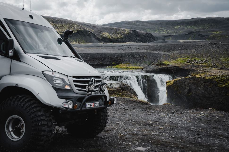
Even after the roads officially open in late June, there is still a lot of snow on the hiking trails and in the mountains. The rivers are swollen, the vegetation has not awoken completely, and the paths are very muddy in the early summer season.
After the summer, the first snow usually arrives in September - sometimes as early as late August in the Highlands. From the middle or the end of September, the interior of the country can become covered by snow.
During the winter, the Highlands are completely inaccessible for any type of rental car. It is, however, possible to reach the area via guided Superjeep or snowmobile tours. Taking a winter tour to Landmannalaugar is an amazing idea.
The base camp is almost completely empty with only a few tour guests staying over, so there are no crowds around. The hot spring is always warm and welcoming and the landscape is amazingly wintery and unspoiled. Admiring the Northern Lights from the hot spring or enjoying the cozy atmosphere in a nice, heated hut far from civilization in the middle of nowhere - this is something that deserves a spot on your bucket list!
You can buy a detailed hiking map of the area at the campsite in Landmannalaugar. However, if you are not hiking with a group, it is strongly recommended to have a GPS device with a map downloaded on it.

The weather and hiking conditions in the Highlands are very unpredictable. While the paths are well marked, there can be long parts covered with snow or the wind can blow away some markers. Visibility can change from sparkling sunshine to thick fog in a matter of minutes, especially higher up in the mountains. As network coverage is unstable in the Highlands, having a GPS device can save your life in a dangerous situation.
Even though this is a valley, Landmannalaugar is still located in the Highlands where the weather can be particularly wicked sometimes. Very strong and steady tents are recommended for those who are planning to camp here.
Hiking in the Highlands requires very good quality equipment. Good, sturdy, waterproof hiking boots and multi-layered clothing that are designed for outdoor activities are a must. Good insulation along with a water and windproof shell layer are essential.
Always check the weather forecast and the warnings before heading to Landmannalaugar. Once you are there, make sure to ask about the trail conditions and weather warnings at the information point before heading out for a hike. If you are hiking alone, download the SafeTravel app and make sure to submit your travel plans before you leave.
If you are not an experienced hiker or if you are traveling alone, it is recommended that you go on a guided tour with a group. The hiking guides are specially trained to guide you safely through this landscape and cope with the sometimes challenging conditions that hikers can face in Iceland.
Please note that Landmannalaugar is a highly protected area. Camping in the Fjallabak Nature Reserve, outside of the designated campsites, is both forbidden and unsafe. There are huts along the Laugavegur Trail which you can pitch your tent next to.
Never step off the trail, not even if it is muddy. Do not step on the moss. Respect any closures and do not leave any waste behind. If you find a small bit of trash on the trail, it is a nice idea to pick it up and take it with you to the next garbage can.